

Advertisement


~ Ministry to develop national spatial data infrastructure plan for St. Maarten ~
POND ISLAND — Last week, VROMI Minister Miklos Giterson, along with his Secretary General Louis Brown, attended the Latin America GeoSpatial Forum in Mexico City. The forum, which was held from November 6 to 8, 2018, saw representatives from over 40 countries gathered under the theme “GeoSpatial Information: Making a Difference for Millions”.
The forum is the largest regional conference on geospatial information and technologies and it provided a platform to meet and network with regional leaders and experts from the geospatial domain, the minister explained during Wednesday’s Council of Minister’s press briefing.
The forum provided great insights into many different areas and two focuses that were of particular interest to the minister were the symposium on climate change and natural disasters and the symposium on construction and engineering.
“In both symposiums it was discussed and demonstrated how geospatial information can be used to develop national strategic plans that can in particular help us
in measuring the environmental, social and economic impact of natural disasters as well as how we can start our move towards more resilient planning and better design of infrastructure.” Minister Giterson said.
“This forum tied perfectly in with the national spatial data infrastructure consultation that the ministry held in August.” the minister continued. “One of the main goals of that consultation was to discuss the importance of sharing each organization’s GIS layers in order to create maps with more accurate and detailed information.”
“As we took note in Mexico how the technology is implemented in countries much larger than ours, we are now task with how we will translate that information to work for us here in St. Maarten.” Minister Giterson concluded.
###
Relevant links and forum details:
GIS (Geographic Information System)
Latin America Geospatial Forum is the largest and most prestigious regional conference on geospatial information and technologies. Throughout the years, it has succeeded in consistently attracting the world’s best and brightest in the field, creating opportunities for conference attendees to learn about geospatial’s most important issues through first-hand interactions with peer experts, emerging and established companies. As the geospatial market continues to grow in importance and influence, the conference will play an integral role in keeping the professionals across the region connected and educated. The platform has been highlighting the value and power of geospatial technology as an enabler in addressing economic and socio-economic issues. It is one of the ‘must-attend’ events for geospatial professionals, featuring largescale conference and exhibition, top-ranked keynote speakers, major industry segments, high-level discussion programs, and networking event. – Latin America GeoSpatial Forum
###
Official Press Release
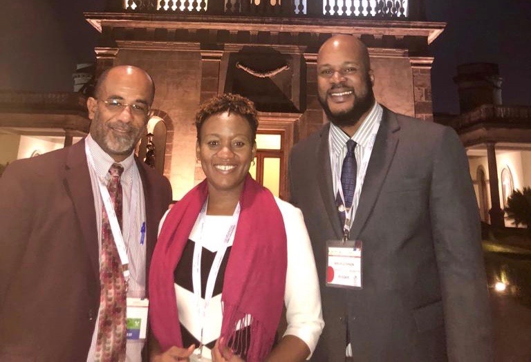
Photo caption: From left to right: Louis Brown – VROMI Ministry Secretary General, Makini Persaud-Hickinson – Head of Department of Statistics TEATT Ministry, Minister Giterson of VROMI Ministry. Photo provided by VROMI ministry cabinet.
Minister Giterson attends Geospatial Forum in Mexico
PHILIPSBURG – Minister of Public Housing, Spatial Planning, Environment and Infrastructure (VROMI) Miklos Giterson recently attended, along with Secretary General Louis Brown, the Latin America Geospatial Forum held in Mexico City, Mexico. The forum, which saw representatives from over forty countries, gathered under the theme: Geospatial Information: Making a Difference for Millions. This forum is the largest regional conference on geospatial information and technologies and it provided a platform to meet and network with regional leaders and experts from the geospatial domain.
Minister Giterson explains, “The forum provided great insight into many different areas in which geospatial information technology is being used to acquire, manipulate, and store geographic information. There were a number of interesting sessions at the forum; two focusses that were of particular interest to me were the symposiums on Climate Change & Natural Disasters and Construction & Engineering. These sessions were very timely given Sint Maarten’s, and all small island developing state’s, vulnerability to climate change and the resulting increase of natural disasters that we are now faced with.”
During the symposium on Climate Change and Natural Disasters it was discussed and demonstrated how geospatial information can be used to develop national strategic plans that can help in measuring the environmental, social and economic impact of natural disasters. Also discussed at that symposium was the use of geostatistical networks for monitoring biodiversity and climate change and geostatistical solutions for the study of territorial and environmental dynamics. The Constructing and Engineering session focused on moving countries towards more resilient planning and a better design of infrastructure. It also touched on ways to operate and maintain infrastructure efficiently and effectively as well as post-disaster infrastructure reconstruction and recovery.
Minister Giterson believes that attendance at this forum was of particular importance since it tied perfectly to the National Spatial Data Infrastructure consultation session the VROMI Ministry held in August with a number of community stakeholders. One of the main goals of that consultation session was to discuss the importance of sharing each organization’s GIS layer in order to create maps with more accurate and detailed information.
In its completed state the National Geographic Information System of St. Maarten will feature information on all established zoning plans, protected monuments, issued permits, and countless other geospatial data features that may be useful for planning, policy development, enterprise asset management and other purposes. This system will be particularly beneficial to institutions that require accurate and current digital geographic information about St. Maarten to increase their service efficiency and effectiveness.